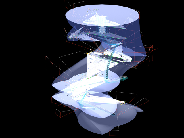
Tom Wu, MArch II Studio Project: BEATTY FORD ISLAND, 2007 "In gleaning/scanning, unintentional disturbances inevitably occur, thus at unpredictable, but site-specific conditions there emerge moments that manifest a reversal of intentionality."
This just in… Surface Cities presents experimental projects in digital video and still images of the city as understood through simulated environments, namely Google Earth. The experimental images of the city begin with the premise that we increasingly navigate through real environments by first encountering them in fictive representations. The projects have a clairvoyant proclivity. They propose that: “Exposing the city’s unique structure and patterns of use in Google Earth’s gravitationless, layered environment is, like Kevin Lynch’s studies in the Image of the City, not only a necessary precondition for manipulating its image, but in fact can already reveal existing alternative images.” The web site is maintained by [full disclosure] my friends and former colleagues John Zissovici and Yanni Loukissas, the latter of whom was mentioned here before, in a somewhat related post. The projects include work by them as well as by their students.
Some of the projects are more straightforward than others. In one, the image of the city revealed is that of the extreme commuter. In another, a “continuous line that changes and transforms on its path through the Bronx, Manhattan and Brooklyn following one of the favorite graffiti artists’ subway lines.” A third looks at golf driving ranges. And on the more rarefied side, take a look at the “extra dimensionality (…) harvested from interference patterns, derived from the procedure of paired scanning, as the means to generate the manifold of an atlas.” (Whew). The magnum opus may be the 8 min, 33 sec Angel Dust, 2009, by Zissovici and Loukissas themselves, an exploration of the space implied by the cross-Manhattan expressway fantasized by Robert Moses but never built, suggesting that by knowing the spaces that never were, there is something to learn about the city that is. Take a look (but be patient if the Quicktime movies take a few minutes to load). Highly recommended: Surface cities.

Maiko Muranaka, MArch II Studio Project: A TOUR OF WASHINGTON D.C., 2007 | Instructors: John Zissovici and Paul Soulellis
This looks like the drawing Yanni made of Rome 10 years ago! The technology has finally caught up to his brain…